ARMSNET
Military Equipment Database
Initializing 0%

DJI Matrice 30T Chinese Unmanned Aerial Vehicle (UAV)

DJI Matrice 30T

Tactical Unmanned Aerial Vehicle (UAV)
Spotted an error? Sign in to suggest an edit.
Basic Information
Name
DJI Matrice 30T Chinese Unmanned Aerial Vehicle (UAV)
Designation
DJI Matrice 30T
Alternate Designation
DJI Matrice 30T
Equipment Type
Tactical Unmanned Aerial Vehicle (UAV)
Manufacturer
DJI
Date of Introduction
2021
Description

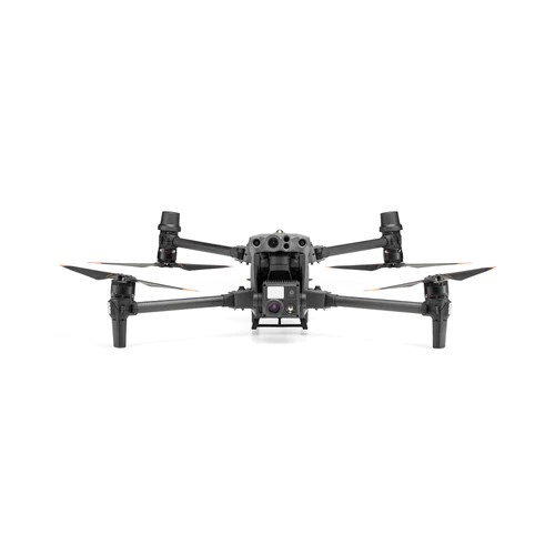
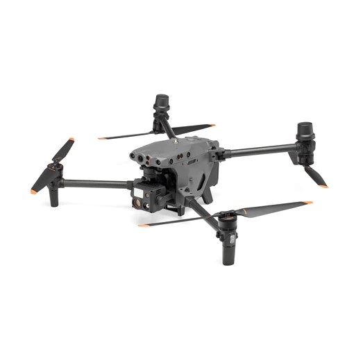
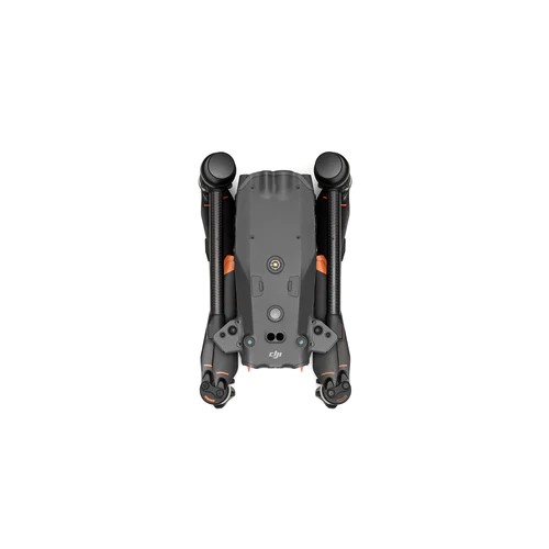
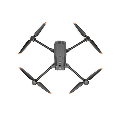
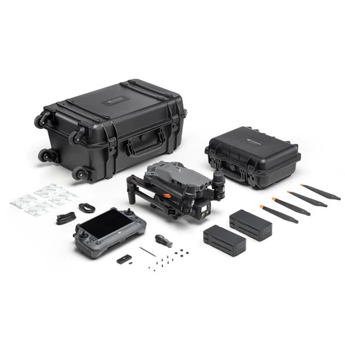
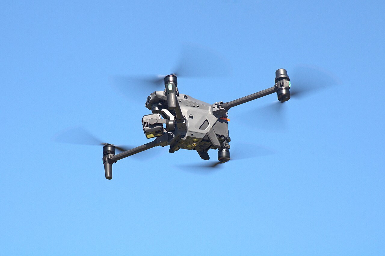
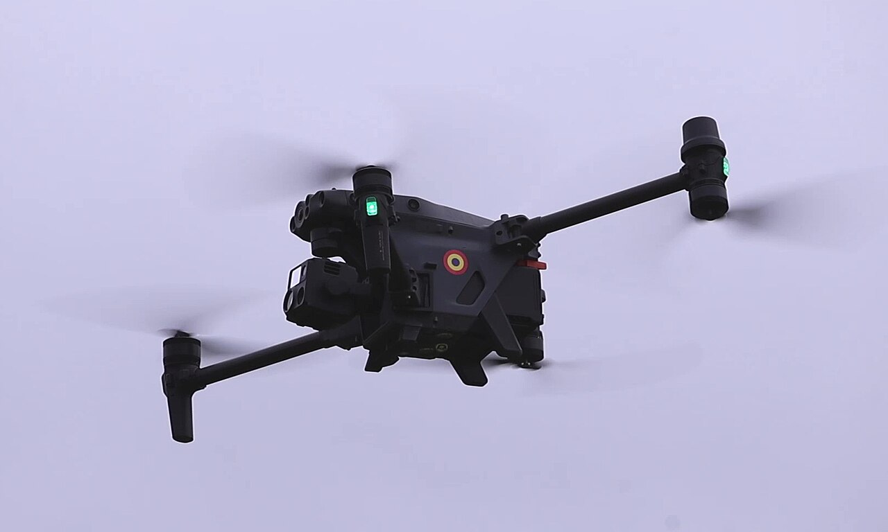
The DJI Matrice 30T Chinese Unmanned Aerial Vehicle (UAV) is the DJI Enterprise flagship, a weatherproof drone that fits in a backpack. It integrates multiple high-performance sensors into one single camera payload, is controlled with the DJI RC Plus Remote, and runs on upgraded DJI Pilot 2 software, which significantly improves the flight experience. The powerful M30T offers the endurance and capability necessary for rugged professional use cases. Additionally, its size makes it ideal for easy transportation and fast setup. The UAS also includes a 40mm 640x512 30fps thermal imaging camera with a measurement accuracy of ±2°C or ±2%. Apart from its outstanding performance and new format, the DJI M30T allows professionals to fly and perform beyond their immediate surroundings. It integrates smoothly with the new DJI FlightHub 2 fleet management cloud-based software and the DJI Dock for collaboration with remote and unattended operations, bringing efficiency innovation to various industries. The M30T model integrates a 48-megapixel 1/2'' CMOS sensor-zoom camera with 5×~16× optical and 200× digital zoom, a 12-megapixel wide-angle camera, 8K photo, 4K/30 fps video resolution, and a laser rangefinder which can give the precise coordinates of objects up to 1,200 meters away.

Air & Air Defense Specifications
Engine Electric
Max Speed 75.6 km/h
Range 1.2 km
Service Ceiling 5000 m
System
Alternate Designation DJI Matrice 30T
Type Unmanned Aerial Vehicle (UAV)
Manufacturer SZ DJI Technology Co., Ltd. or Shenzhen DJI Sciences and Technologies Ltd
Crew Unmanned
Operating Frequency 2.4000-2.4835 GHz; 5.725-5.850 GHz
Transmitter Power (EIRP) 2.4 GHz: <33 dBm (FCC); <20 dBm (CE/SRRC/MIC) 5.8 GHz: <33 dBm (FCC/SRRC); <14 dBm (CE)
GNSS GPS+Galileo+BeiDou+GLONASS (GLONASS is supported only when RTK module is enabled)
Operating Temperature -20° to 50° C (-4° to 122° F)
Launching System Vertical Take-Off and Landing (VTOL)
Recovery System Vertical Take-Off and Landing (VTOL)
Dimensions
Length, Unfolded 470 mm
Width, Unfolded 585 mm
Height, Unfolded 215 mm
Length, Folded 365 mm
Width , Folded 215 mm
Height, Folded 199 mm
Diagonal Wheelbase 668 mm
Maximum Takeoff Weight 4,000 grams
Automotive
Engine Name INA
Engine Type Electric
Engine Power INA
Maximum Speed INA
Service Ceiling 5,000 m
Control Radius INA
Hovering Accuracy Vertical: ±0.1 m (Vision System enabled); ±0.5 m (N-mode with GPS); ±0.1 m (RTK) Horizontal: ±0.3 m (Vision System enabled); ±1.5 m (N-mode with GPS); ±0.1 m (RTK)
RTK Positioning Accuracy 1 cm+1 ppm (horizontal) 1.5 cm+1 ppm (vertical)
Max Angular Velocity Pitch: 150°/sec.; Yaw: 100°/sec.
Max Tilt Angle 35° (N-mode and Forward Vision System enabled: 25°)
Max Ascent/Descent Speed 6 m/s, 5 m/s
Max Tilt Descent Speed 7 m/s
Max Horizontal Speed 23 m/s
Max Wind Resistance 15 m/s 12 m/s during taking off and landing
Max Hover Time 36 min
Max Flight Time 41 min
Details
Country of Origin China
Category Very Low-Cost, Close-Range UAVs (Less than 5 km Range)
Air > Very Low-Cost, Close-Range UAVs (Less than 5 km Range)
Filter Label
D
Classification
Domain
Air & Air Defense
Equipment Status
Active
Dimensions
Length
Width
0.59 m
Height
0.22 m
Weight
4 kg
Operators (1)
China
Something went wrong. Please reload the page. Reload